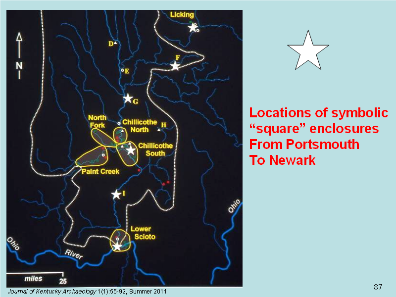
Christopher Gist, a frontier guide, in 1751 followed an old trail from the Licking into the Scioto drainage in the vicinity of Rock Mill (Squier and Davis 1848: Plate XXXVI, No.3, F above) through Circleville (Squier and Davis 1848: Figure 10, G above) along the east side of the Scioto through Chillicothe and near Seal (Squier and Davis 1848:Plate XXV, I above) to Portsmouth and beyond. The existence of this trail suggests a likely path that connected the sites in Pre-Columbian times (Greber 2006:103).
As the southern anchor point of the distribution, the Portsmouth Works appear to be of some special significance. Which social groups designed, built, and used the walls and mounds on the north and south banks of the wide river? Where did they live during this process? Were they “Hopewells” in Kentucky or “Adena” relatives in Ohio. Or, perhaps the builders had not yet established state borders. Our interpretations of the extensive Portsmouth Works are severely hindered by a common problem in studies of the earthworks in the Middle Ohio Valley; we do not know the calendar years during which the extensive constructions on both banks of the river took place.